MapTalk
The interactive participation tool for spatial plans and developments
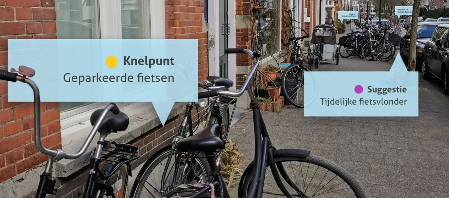
Engaged citizens want to have their say on plans in their neighborhood. At the same time, governments struggle with participation that often comes too late or delivers too little. A gap that can only be closed with accessible, visual tools.

The interactive participation tool for spatial plans and developments
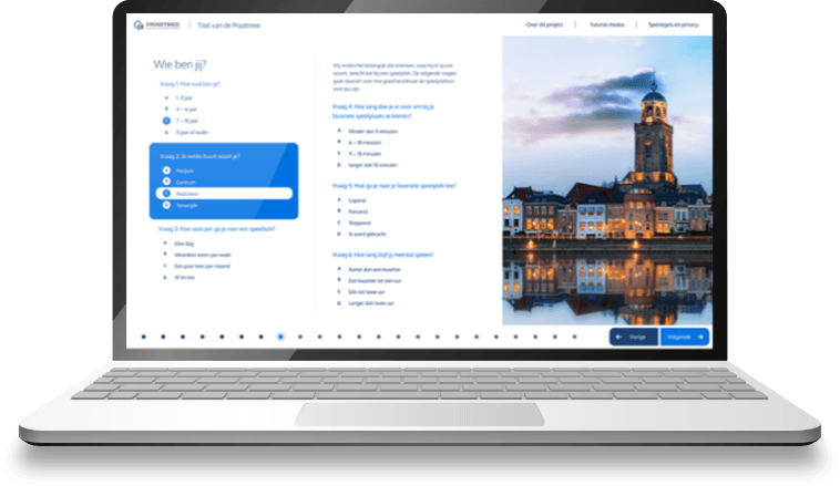
MapTalk is an online application with an interactive map that allows residents to respond to ideas and plans in their living environment: fast, simple and user-friendly.
Anyone can share their opinion with MapTalk from home, at work or elsewhere. MapTalk is so easy to use that seniors and young people can work with it effortlessly. All responses are collected in a secure environment, accessible only to the project administrator, such as a project manager or communications officer.
Why MapTalk?
Engage residents directly on the map – quickly and easily
Secure environment for all responses in one place
Works for everyone: young and old, at home or on the go
From participation to insight in one platform
Interactive participation maps
User-friendly interface


Start today with MapTalk
Transform your workflows with powerful Geo-ICT solutions. More than 500 organizations trust MapGear for their geographical information – with MapTalk as one of our solutions. Join satisfied customers worldwide.
Discover our other products
Expand your Geo-ICT toolkit with our complete range of innovative solutions
Online GIS platform for spatial intelligence across your organization
More about GeoAppsCatalog, tooling & hosting for real-time geodata as web services
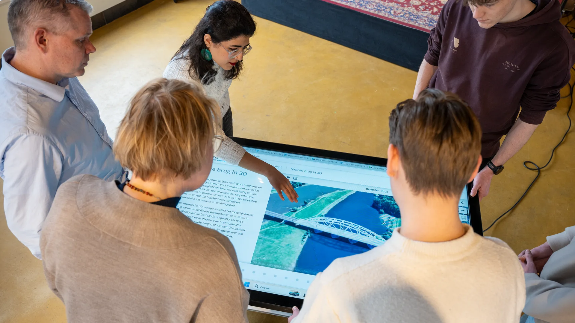
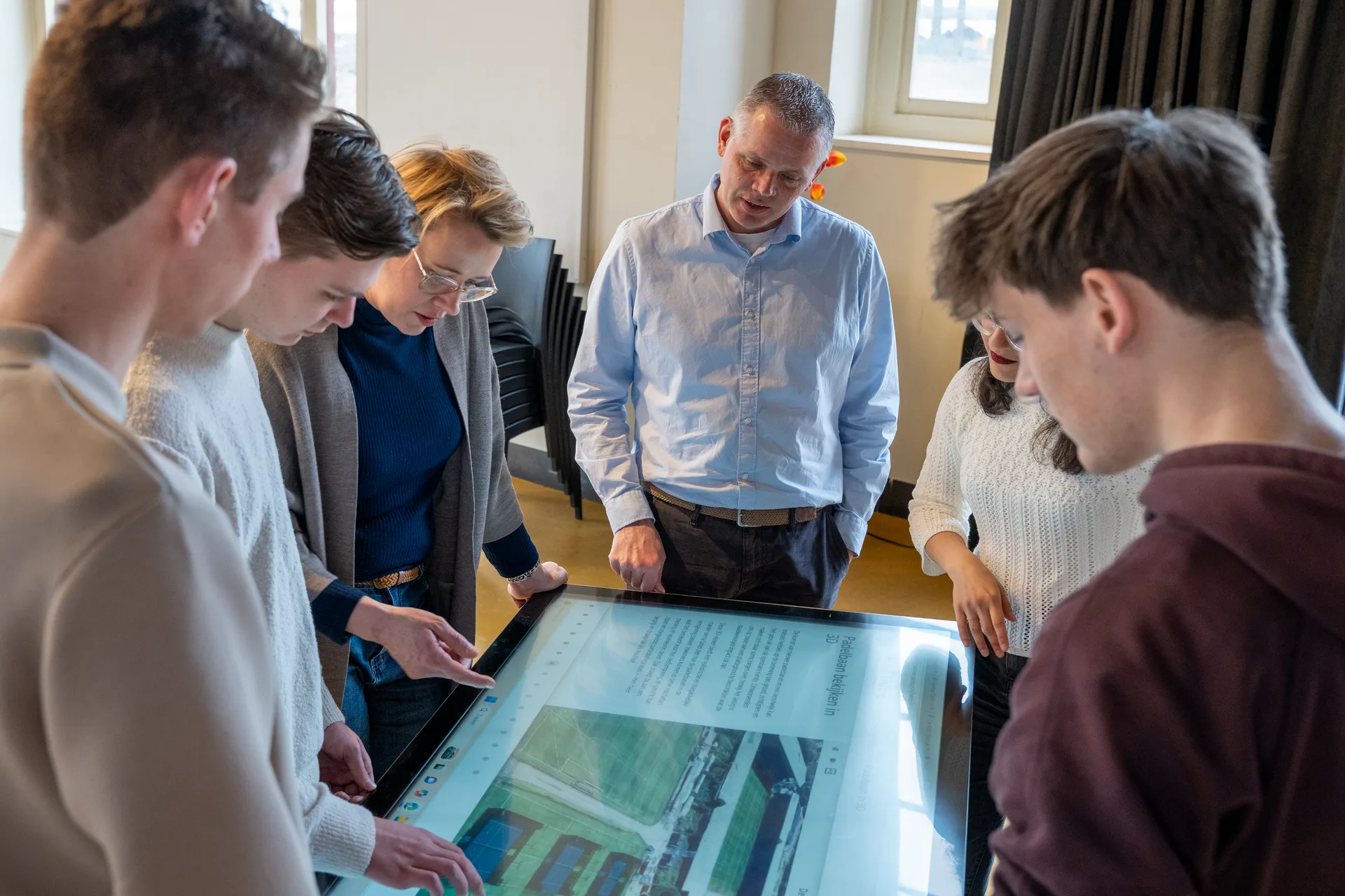
More about MapServicesThe digital map table for trade fairs, events & workshops
More about TouchTableInsight into energy transition & climate adaptation with maps, dashboards and reporting
More about DuurzaamheidskaartWant to know more?
Do you have questions and want to know more about one of our products or request a demo? Fill in the contact form so we can get in touch with you.